Autonomous Marine Robotics Manufacturer
Reservoir Dam Safety Inspection USV and ROV: Deployment Guide
A reservoir dam safety inspection USV and ROV resolves cracks and scour to 3 cm and removes 60-80% of dive days. Test the depth, tether and accuracy thresholds.

A reservoir dam safety inspection USV paired with a tethered ROV inspects the upstream face, spillway and downstream toe without putting divers in the water. A two-person crew can cover a 500 m concrete gravity dam in one working day, hold crack and scour positions to 3 cm horizontal accuracy, and remove 60-80% of the dive days a conventional campaign requires. This guide sets out the payload, positioning and procurement thresholds that belong in a tender document.
Key takeaways
- A surface USV is a deployment and telemetry platform first: what matters is holding station within 0.5 m RMS while the tether pays out, not hull speed.
- Crack and scour records repeat year-on-year only when both vehicles reference one control network at 3 cm horizontal and 5 cm vertical accuracy.
- ROV depth rating should exceed the deepest inspection point by 25%, and umbilical length the same point by 20%, to cover plunge-pool depth and transducer hang-down.
- A 500 m concrete gravity dam can be surveyed in one working day by two operators, including control setup, launch and a bathymetric toe sweep.
- Diver-free screening removes 60-80% of dive days but does not remove divers: tactile probing and repair still require them.
- Budget 30-40% of five-year cost for calibration, technicians and maintenance, not only for hull and payload capital.
What reservoir dam safety inspection requires in practice
Reservoir dam safety inspection refers to the periodic condition assessment of a dam’s upstream face, crest, spillway, outlet works and downstream toe, carried out to detect cracking, joint opening, surface loss, seepage and scour before they compromise structural performance.
Because the failure modes that matter most – internal erosion, foundation scour, conduit deterioration – begin below the waterline, a surface-plus-subsea configuration is defined as the minimum equipment set for a complete condition survey. Most national regimes schedule inspection on a fixed cycle of annual visual, five-year detailed and ten-year comprehensive review, and the recurring cost is dominated by mobilisation rather than by the survey itself.
| Mission parameter | Typical requirement | Why it matters |
|---|---|---|
| Maximum inspection depth | 10-60 m, set by drawdown | Sizes ROV depth rating and tether reserve |
| Positioning accuracy | ≤ 3 cm horizontal, ≤ 5 cm vertical | Crack maps must overlay year-on-year |
| ROV umbilical length | ≥ 1.2x maximum depth | Prevents tether lock on upstream transit |
| Surface endurance | 4-6 h at survey speed | Covers 2-3 km of dam face per sortie |
| Imaging | ≥ 1080p video, 2 MP stills | Supports crack-width measurement at 1 m standoff |
| Toe bathymetry | 5-10 m line spacing, ±0.05 m | Detects scour volume change between cycles |
Three configurations that decide the survey design
High concrete gravity dam, 40-60 m face
At a 60 m face the binding constraint is tether management, not vehicle capability. A 300 m-rated ROV on a 120 m umbilical is adequate in depth but marginal in handling: the umbilical has to be neutrally buoyant over its full length, or current drag at mid-depth pulls the vehicle off the wall. Operators therefore work from a USV holding station 3-5 m off the face, flying horizontal passes at 0.3-0.5 m/s with the camera 1-2 m from concrete. A 50 m segment takes 2-3 minutes to fly but 8-10 minutes to reposition, so line planning determines output far more than transit speed.
Earthfill embankment with riprap
Riprap slopes defeat both sonar and video: the surface is acoustically rough and visually chaotic. A 300 m-rated open-frame ROV with forward-looking sonar resolves displaced armour units at 2-5 m range, but classification of individual stones is unreliable below 1 m. The defensible deliverable is a differential survey – the same lines at the same spacing two to five years apart – which shows displacement and loss rather than absolute condition. Expect 60-70% of on-site time to go into re-establishing those lines.
Spillway stilling basin and outlet works
Stilling basins concentrate the hardest conditions: turbulent flow, entrained gravel, near-zero visibility and steel trash racks that snag tethers. Inspection windows are set by gate closures, so the survey has to fit inside a 4-6 hour window. An eight-thruster full-attitude ROV is preferred here because it holds orientation against vertical faces and translates laterally without yawing. Sonar is the primary sensor and video documents what sonar has already flagged – not the reverse.
Platform and payload configuration
Surface platform
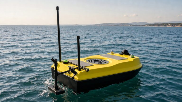
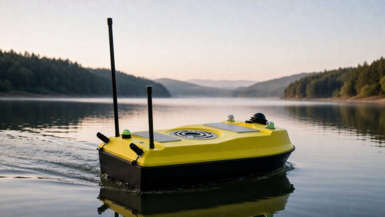
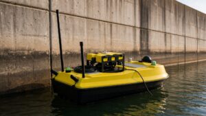
The surface vessel is selected for station-keeping and deck access rather than speed. It must hold position within 0.5 m RMS in light wind while the ROV pays out or recovers, carry an RTK GNSS/INS mast and a telemetry relay, and run 4-6 hours on one battery set. A central deployment well or a low transom reduces tether chafe compared with over-the-side handling; on a 1.2 m monohull the practical arrangement is an aft deck cradle with the umbilical led through a fairlead.
Subsea vehicle
The subsea element is a work-class ROV, because close inspection depends on continuous operator judgement and instant reverse. A six-thruster vectored layout holds station against cross-current at the face; an eight-thruster full-attitude vehicle is the better choice for vertical walls, energy dissipaters and trash racks. Fit the manipulator arm even when no repair is planned: it is the only way to confirm that a mark is a crack and not a stain.
Sensor and data chain
The ROV stack combines forward-looking sonar for crack and spall detection, profiling sonar for scour, an HD camera with auxiliary lighting and an altimeter for standoff control. On the surface the USV logs its own GNSS/INS track plus the ROV position from USBL or tether count. Both streams are time-stamped to a common clock, so a video frame and a bathymetric point captured at the same instant can be co-registered. Without that shared reference a crack map is a picture, not a record.
Compliance and permitting
Dam inspection is a regulated activity before it is an engineering one. The International Commission on Large Dams (ICOLD) publishes the technical bulletins that most national regulators adopt, and the US Bureau of Reclamation dam safety programme is the reference implementation for risk-informed inspection intervals.
Confirm four items in writing before mobilising: authorisation from the reservoir owner, a safety plan countersigned by the dam safety officer, radio licensing for telemetry and RTK corrections, and any navigation or exclusion-zone requirement where the reservoir carries traffic. Where bathymetric deliverables are contractual, name the survey order – IHO S-44 Order 1b is the usual floor for scour mapping at 5 cm vertical uncertainty; where the owner’s quality assurance follows a national scheme instead, tie the same tolerance numbers to the published NOAA hydrographic survey standards so that both parties are reading one specification.
Deployment workflow
- Survey design (45 min): divide the dam into 50 m face segments and flag priority zones – spillway lip, stilling basin, toe drains and outlet structures – then set toe-sweep line spacing at 5-10 m.
- Control network (30 min): establish or verify ground control points and the RTK base, and log the base position into the inspection file so the next cycle references the same datum.
- USV launch (10-15 min): deploy from the crest access road or a downstream ramp; two operators are sufficient for a 1.2 m monohull with an aft deck cradle.
- ROV close inspection: fly each 50 m segment at 0.3-0.5 m/s with 1-2 m standoff, recording continuous video and sonar against the logged track.
- Toe and plunge-pool sweep: run bathymetric lines at 5-10 m spacing, then difference the surface against the previous cycle to compute scour volume change.
- Reporting (same day): co-register video frames to the bathymetric surface, flag defects above the action threshold, and archive raw data with the control log.
Cost and procurement considerations
Total cost of ownership
Over five years a reservoir dam safety inspection USV and ROV programme typically splits 35% platform and payload capital, 30% technician labour and travel, 20% calibration and repair, and 15% software and storage. The saving that carries the business case is not the survey cost but the dive-team mobilisation it removes: a commercial dive spread on a deep or low-visibility reservoir can exceed US$10,000 per day before inspection work begins. At two dive campaigns a year, that line alone repays a mid-range USV-ROV system within three to four years, before counting reduced gate-closure downtime.
Selection checklist
| Buying criterion | What to verify | Acceptance threshold |
|---|---|---|
| ROV depth rating | Rated depth against deepest planned point | ≥ 1.25x maximum drawdown depth |
| Umbilical length | Tether reserve at full depth | ≥ 1.2x maximum depth |
| Positioning repeatability | Revisit a fixed marker after 30 min | ≤ 5 cm horizontal RMS |
| Station-keeping | USV holds position with ROV deployed | ≤ 0.5 m RMS for 10 min |
| Crack measurement | Known-width reference target at 1 m | Sub-millimetre resolution |
| Data export | GeoTIFF, point cloud, time-stamped video | Imports to owner GIS without conversion |
Configuration pricing varies with payload mix and depth rating; request a written quotation against the acceptance thresholds above rather than comparing headline platform prices.
Frequently asked questions (FAQ)
How does a reservoir dam safety inspection USV differ from a general survey USV?
A reservoir dam safety inspection USV is a deployment and telemetry platform for a close-range ROV, whereas a general hydrographic USV is optimised for wide-area bathymetry. Dam work demands precise station-keeping with a tether deployed, a deck arrangement that protects the umbilical, and centimetre-grade georeferencing so crack positions align between inspection cycles.
Can an ROV replace dive teams entirely for dam inspection?
No. An ROV replaces divers for visual and sonometric screening, covering the upstream face, stilling basin and trash racks without exposing anyone to low visibility, cold water or entrapment, and it cuts dive days by 60-80%. Tactile probing, repair and anything requiring physical contact still need a diver.
What conditions stop a USV-ROV dam inspection?
Operations normally pause when wind-driven waves exceed sea state 3, when flow near an outlet exceeds 0.5 m/s, or when turbidity drops visibility below the camera’s effective range. The USV itself tolerates rougher water than the ROV: it is ROV station-keeping and image quality that fail first, not the surface platform.
How long does a dam face survey take?
A 500 m concrete gravity dam – control setup, launch, ROV close inspection and a bathymetric toe sweep – takes one long day with a two-person crew. Adding full-coverage video mosaicking extends the campaign to two or three days, and dense crack mapping at 0.5 m line spacing roughly doubles ROV flight time.
What depth rating should a dam inspection ROV have?
Specify at least 1.25 times the deepest point you expect to inspect, including plunge-pool depth below the toe. A 60 m reservoir therefore calls for a 75 m minimum rating, and a 300 m-rated vehicle is the practical default because it leaves margin for drawdown changes without a second purchase.
Recommended OrcaUSV configurations
- Dedicated close inspection: the XRV2 6-Thruster Modular Underwater Inspection ROV holds station at a dam face and carries a sonar and camera stack in a compact open frame.
- Full-attitude work: the XRV3 8-Thruster Full-Attitude Underwater ROV suits vertical walls, stilling basins and complex energy dissipaters where lateral translation without yaw matters.
- Surface platform and bathymetry: the XHS50-ADCP ADCP Integrated Hydrographic Survey USV provides the stable deck, RTK GNSS/INS positioning and sonar payload needed for the toe sweep.
These platforms sit within OrcaUSV’s wider Marine & Water Conservancy solution set, which covers reservoir, river and coastal infrastructure inspection.
Further reading
- Water resource assessment with USV and ROV – the storage-volume and sedimentation survey that usually precedes a dam safety campaign.
- UUV explained: AUV versus ROV – helps decide whether autonomy adds value on the open-water portions of a reservoir survey.
- Ultimate guide to buying an unmanned surface vehicle – the procurement framework behind the selection checklist above.