Autonomous Marine Robotics Manufacturer
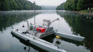
A water resource assessment USV measures reservoir storage volume, sedimentation and vertical water quality profiles, delivering S-44 compliant data that supports water rights, allocation and withdrawal-permit decisions.

For basin authorities, water utilities and hydrology bureaus, a water resource assessment USV converts reservoir and lake evaluation from a multi-week crewed-boat campaign into a repeatable two-person procedure. One 8-hour sortie covers 3–5 km², resolving storage volume to within 2% of capacity, sedimentation to ±0.05 m, and logging water-quality profiles at 30+ stations per day. The same platform deploys an ROV to inspect submerged outlets and dam faces to 500 m depth.
Key takeaways
- A water resource assessment USV measures storage volume, sedimentation and water quality over large reservoirs at 30–60 survey line-km per day.
- RTK GNSS at ±2 cm with an echo sounder rated to ±0.05 m keeps storage-volume error below 2% on a typical 10 km² impoundment.
- Integrated USV+ROV operation adds inspection of outlets, intakes and dam faces to 500 m depth in the same mobilisation.
- Deliverables — storage-elevation curves, sedimentation maps, water-right verification data — export as IHO S-44 compliant records within 24 hours.
- Five-year total cost of ownership typically runs 40–60% below crewed-boat campaigns once crew, fuel and safety overhead are counted.
What a water resource assessment USV must deliver in practice
Water resource assessment is defined as the systematic measurement of water volume, quality and underwater terrain in a basin, producing the quantitative basis for water-right confirmation, allocation and withdrawal-permit management. The parameters that constrain procurement are accuracy, daily coverage and reporting-chain integration.
| Mission parameter | Typical requirement | Why it matters |
|---|---|---|
| Positioning | RTK GNSS, ±2 cm horizontal | Ties every sounding to a legal coordinate |
| Bathymetric accuracy | ±0.05 m or 1% of depth | Keeps volume error under 2% |
| Daily coverage | 3–5 km² or 30–60 line-km | A 10 km² reservoir finishes in 2–3 days |
| Endurance | ≥ 8 h per battery set | One sortie per working day |
| Water quality profiling | CTD plus sampler, 30+ stations/day | Vertical profiles support allocation models |
| ROV depth rating | 300–500 m class | Covers deep outlets and dam faces |
Platform and payload configuration
Surface platform
The baseline platform is a twin-hull catamaran of 30–60 kg carrying 15–25 kg of payload, with draft under 0.3 m and station-keeping within 0.5 m RMS. Two people launch it from a slipway or bank ramp in under 20 minutes; no crane is needed below the 60 kg class. Course-keeping against 1.0–1.5 m/s currents covers reservoir headwater inflows.
Subsea vehicle
For inspection tasks, a compact open-frame ROV in the 300–500 m depth class deploys from a deck davit. It carries an HD camera, lighting rated for turbid water and, optionally, a scanning sonar. Sharing one mobilisation between the mapping pass and the inspection removes a separate dive mobilisation, typically saving 3–5 days per campaign.
Sensor and data chain
The standard payload pairs an RTK GNSS/INS receiver, a single-beam echo sounder, a CTD probe and a 2–5 L sampler. All channels are time-stamped at 1–10 Hz, so volume, quality and position resolve into one record. Telemetry uses 4G/5G with a 10 km radio fallback; data export as CSV and GIS layers within 24 hours, using the same architecture as the real-time water quality monitoring workflow.
Compliance and permitting
Deliverables for water-right and allocation work are normally specified to IHO S-44 Order 1a or better, with RTK GNSS tied to the national datum. Before mobilising, confirm in writing: navigation-authority notification, environmental permits for drinking-water-zone sampling, radio licensing, and ROV lockout/tagout near submerged intakes. Most crews suspend operations at sea state 3 or winds above 15 m/s.
Deployment workflow
- Survey design (1 day before): plan line spacing at 2–5 times water depth and a 200–500 m CTD station grid.
- Launch and calibration (30–45 min): launch the USV, run a sound-velocity cast, verify RTK fix quality.
- Bathymetric coverage (4–6 h): run the grid at 3–5 m/s, logging depth, position and quality flags.
- Water quality profiles (1–2 h): cast the CTD to 0.5 m above bottom and trigger the sampler at defined depths.
- ROV inspection (1–2 h): deploy the ROV on the flagged outlet, intake or dam face and record video with positioning overlay.
- Processing and QA (same day): build the storage-elevation curve and export S-44 compliant deliverables within 24 hours.
Cost and procurement: water resource assessment USV budgets
Total cost of ownership
Over five years, a representative split is roughly 40% platform and payload capital, 25% crew time and travel, 15% calibration and spares, and 20% software, communications and data management. Crewed-boat equivalents run 3–5 times the daily crew cost; contact sales for configuration pricing.
Selection checklist
| Buying criterion | What to verify | Acceptance threshold |
|---|---|---|
| Volume accuracy | Repeat survey of a reference basin | Storage error < 2% of capacity |
| Positioning integrity | RTK fix retention across the lake | ≥ 99% fixed solutions |
| Endurance | Full-day grid at survey speed | ≥ 8 h with 20% reserve |
| ROV compatibility | Davit lift, tether management, power | 300 m class or deeper |
| Data deliverables | Export into bureau GIS and reporting | S-44 metadata plus CSV/GIS in 24 h |
Frequently asked questions (FAQ)
How accurate is a water resource assessment USV for storage volume?
A water resource assessment USV with RTK positioning and a calibrated echo sounder resolves storage volume to within about 2% of reservoir capacity. Accuracy depends on line spacing — 2 to 5 times water depth — and a current sound-velocity profile.
Can one USV campaign also inspect submerged dam structures?
Yes, when the package includes a 300–500 m class ROV. The USV completes the mapping grid first, then serves as the deployment platform while the ROV inspects outlets, intakes and dam faces.
What water quality parameters can the USV collect?
The standard profiling payload measures temperature, conductivity, depth, pH, turbidity and dissolved oxygen on vertical casts, plus discrete 2–5 L trigger-bottle samples. Laboratories extend the profile to nutrients and metals at 30+ stations per day.
How long does a reservoir assessment take end to end?
A 10 km² reservoir typically needs 2–3 field days for bathymetry and profiling, plus 1–2 days for ROV targets, with final storage-elevation curves and GIS deliverables within 24 hours.
Recommended Orca configurations
- Mapping-led assessment: the XHS50-ADCP ADCP Integrated Hydrographic Survey USV integrates positioning, sounding and telemetry for volume and discharge work on larger impoundments.
- Underwater inspection: the XRV4 500 m Open-Frame Work Class ROV covers deep outlets, intakes and dam-face inspection from the same mobilisation.
- Compact bureau kit: the XHS30 Single-Beam Hydrographic Survey USV suits two-person carry and routine storage surveys on smaller reservoirs and lakes.
These platforms belong to Orca’s wider Marine & Water Conservancy solution set.