Autonomous Marine Robotics Manufacturer
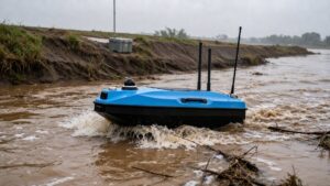
Flood Monitoring USV: Emergency Hydrological Survey Guide
A flood monitoring USV measures stage, discharge and levee scour at the flood peak, reaching decision-grade data within 30 minutes of arrival on site.

A flood monitoring USV measures stage, discharge and levee condition while a flood is still rising – the window when crewed boats are barred from the water and fixed gauges are being overtopped. A trained two-person crew can go from arrival to first transmitted measurement in under 30 minutes, and a moving-boat ADCP transect returns discharge to within 5% of true flow at the exact moment the rating curve is least reliable.
Key takeaways
- The flood monitoring USV exists to measure at peak flow, not to replace a gauging station: its value is the hours when no other platform can be on the water.
- Two people can carry, launch and establish telemetry in 15-30 minutes from a levee crest, with no crane and no crewed support boat.
- A radar stage sensor at plus or minus 2.5 cm paired with moving-boat ADCP discharge at plus or minus 5% produces decision-grade numbers at 1 Hz sampling.
- Dual telemetry – cellular with a 10 km radio fallback – is not redundancy for its own sake: cellular congestion and tower power loss are routine during a flood.
- Suspended sediment, not wave height, is the limiting factor on measurement quality: it attenuates the ADCP signal and can halve the profiling range.
- Transects run at night are normal, because peak discharge frequently arrives between 22:00 and 06:00.
What flood monitoring requires in practice
Flood monitoring is defined as the repeated measurement of stage, discharge, velocity and channel geometry during a flood event, delivered to a control centre fast enough to inform evacuation and reservoir-release decisions. The governing constraint is time: a flood peak evolves over 6-24 hours, so every specification is subordinate to how quickly a number can be produced and trusted.
Fixed gauging stations remain the backbone of a national network, and the USV does not replace them. What it does is cover the two situations where a fixed station produces nothing usable: a stage above the highest value ever gauged, where the rating curve is extrapolated and discharge uncertainty can reach 20-40%, and an ungauged tributary where no station exists at all.
| Mission parameter | Typical requirement | Why it matters |
|---|---|---|
| Time to first measurement | ≤ 30 min from arrival | Flood peaks move in hours, not days |
| Stage accuracy | ±2.5 cm radar water-level sensor | Feeds warning thresholds and rating curves |
| Discharge accuracy | Moving-boat ADCP, ±5% of true flow | The number commanders act on |
| Telemetry | Cellular plus 10 km radio fallback | Coverage collapses exactly when demand spikes |
| Endurance | ≥ 6 h per battery set | Covers a full rise-and-fall cycle per sortie |
| Current tolerance | Course-keeping against 1.5 m/s flow | Mid-channel velocity near the crest |
| Sampling rate | 1 Hz, all channels time-stamped | Stage, velocity and position form one record |
Three deployments that change a decision
Ungauged tributary at peak stage
A 120 m wide tributary with no station reaches 3.2 m stage and 1.8 m/s mean velocity: roughly 690 m³/s, and no one has ever measured it at that level. Two ADCP transects, run upstream and downstream for quality control, take about 11 minutes each including the return leg, so the number reaches the incident controller inside 25 minutes of arrival. The rating curve is then anchored at its most uncertain end rather than extrapolated through it.
Levee toe scour after 36 hours of high water
Sand boils and toe scour appear late in an event, when patrols are tired and visibility is worst. A single-beam sweep along 2 km of levee at 5-10 m line spacing, run at 0.8 m/s, takes 90 minutes and produces a differential surface against the pre-flood survey. The output that matters is not the absolute depth but the change: a toe trench that has deepened 0.6 m since the last dry-season survey is a repair priority, and it is invisible from the crest.
Verifying a reservoir release downstream
When a gate opens, the routing model predicts when and how high the wave arrives downstream. Measuring discharge at three stations 5-15 km apart gives time of travel and attenuation directly. In one common outcome the model over-predicts downstream stage by 0.3-0.5 m, which is the difference between evacuating a road and closing it – and it is only detectable with measured discharge at each station, not with stage alone.
Platform and payload configuration
Surface platform
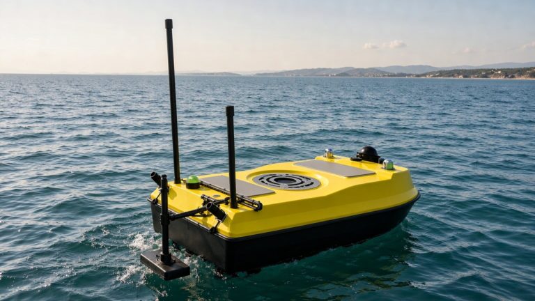
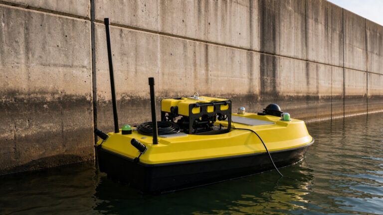
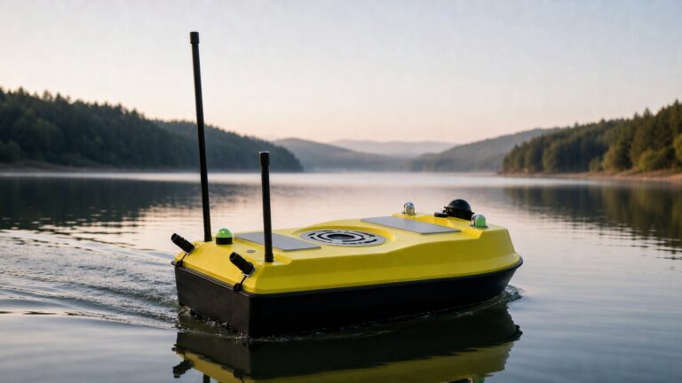
The working platform is a portable monohull in the 25-50 kg launch class, with draft under 0.25 m so it can work the shallow margins where edge discharge is estimated, collision-tolerant hull sections and grill-guarded thrusters for debris. Station-keeping within 0.5 m RMS is required during an ADCP transect, and the deck carries a quick-mount payload plate so the ADCP can be swapped for a single-beam sounder between missions. The XHS30 Single-Beam Hydrographic Survey USV sits at the portable end of this class.
Sensor and data chain
The baseline payload combines a downward-looking ADCP for discharge, a radar stage sensor at plus or minus 2.5 cm, an RTK GNSS/INS receiver and a single-beam echo sounder for cross-section geometry on the falling limb. Frequency choice matters more in flood than in routine survey: a 3 MHz ADCP resolves velocity in 0.25 m cells but loses range quickly in sediment-laden water, while 1 MHz trades cell size for penetration and is the safer default above roughly 1 kg/m³ suspended sediment.
All channels are time-stamped at 1 Hz or better, so stage, discharge and position form a single hydrometric record rather than three files reconciled afterwards. Telemetry is a dual chain – cellular where coverage exists, plus a licence-free 2.4 GHz or 900 MHz radio bridge rated to 10 km where it does not – and data reach the flood-control platform as JSON in under 5 seconds. The real-time water quality monitoring workflow runs on the same architecture.
Debris, sediment and night
Three conditions separate a flood mission from a routine one. Debris fouls propellers and jams in grill guards, costing 10-20% of available thrust exactly when current load is highest. Sediment attenuates acoustics and can blind an optical camera entirely, which is why the ADCP and not the video feed is the primary sensor. Darkness removes visual situational awareness completely, so a flood-capable platform needs navigation lights, a radar reflector and a forward-looking obstacle sensor that works without ambient light.
Compliance and permitting
Emergency status does not remove the paperwork. Written authorisation from the flood-control command centre is required before any vessel enters the water, plus notification to the navigation authority on trafficked reaches. Confirm four items before mobilising: mission authorisation and the operating area, radio licensing for the telemetry link, insurance covering uncrewed operations, and night-operation provisions including lighting and a standby rescue boat.
For the hydrological side, the World Meteorological Organization sets the reference framework through its Guide to Hydrological Practices, which treats discharge measurement uncertainty explicitly rather than as a footnote. National warning services publish their own thresholds – the US National Weather Service flood safety programme and the UK Environment Agency are two operative examples – and the measurement has to be traceable to the datum those thresholds are defined against.
Deployment workflow
- Tasking and risk brief (15 min): confirm transect lines, debris outlook, escape points and the latest hydrological forecast before unpacking.
- Launch (10-15 min): carry the platform to the levee ramp or culvert bank, run the pre-mission checklist and establish the telemetry link before the first transect.
- Discharge transects (about 11 min each): cross perpendicular to flow at 1-2 m/s, repeating every line in both directions so the ADCP software can average out boat-motion error.
- Levee toe and scour sweep (30-90 min): run parallel lines at 5-10 m spacing along sections flagged by patrols, logging depth and position continuously.
- Cross-section on the falling limb (as scheduled): swap to the echo sounder and capture geometry at lower stage, which is when the channel shape can actually be resolved.
- Upload and debrief (15 min): export stage, discharge and cross-section files to the command platform before the next peak cycle begins.
Cost and procurement considerations
Total cost of ownership
Over five years a flood monitoring USV programme typically splits 35% platform and payload capital, 30% crew time and travel, 20% calibration and repair, and 15% communications and software. The avoided cost is crewed work during flood: a hydrometric launch with crew during peak flow runs to several thousand dollars a day and is frequently unavailable when conditions are worst, which makes the comparison less about cost per survey than about whether the measurement happens at all.
Selection checklist
| Buying criterion | What to verify | Acceptance threshold |
|---|---|---|
| Launch logistics | Two-person carry from levee crest to water | ≤ 50 kg total, no crane required |
| Discharge accuracy | Transect against a current-meter reference | Within ±5% of true flow |
| Telemetry failover | Deliberate cellular dropout mid-transect | Radio takeover in under 10 s |
| Sediment performance | Transect in water above 1 kg/m³ sediment | Full-depth profile retained |
| Debris tolerance | Guarded-thruster strike and fouling test | Mission continues after glancing impact |
| Data integration | Export into the provincial flood-control platform | JSON/CSV files within 5 min of mission end |
Packages vary with payload mix and telemetry configuration; ask for a written quotation against the thresholds above rather than comparing platform prices in isolation.
Frequently asked questions (FAQ)
How fast can a flood monitoring USV be deployed during an emergency?
A trained two-person crew can deploy a portable flood monitoring USV and transmit the first measurement within 30 minutes of arriving on site. Launch needs only a levee ramp or culvert bank, and the pre-mission checklist and telemetry setup account for roughly half of that time.
What sensors does a flood monitoring USV carry?
The standard flood payload is a downward-looking ADCP for discharge, a radar stage sensor accurate to plus or minus 2.5 cm, an RTK GNSS/INS receiver, a single-beam echo sounder for cross-sections, and a forward camera for situational awareness in daylight.
Can a USV operate during the flood peak itself?
Within limits, yes. Portable survey platforms hold course against currents up to about 1.5 m/s and operate to sea state 3, which covers most mid-size river reaches. Operations pause for large floating debris, and transects run on the sheltered side of the channel near the platform limit.
How does USV discharge measurement compare with a fixed gauging station?
The two are complementary rather than competing. A fixed station gives continuous stage but its rating curve has to be extrapolated above the highest gauged level, where discharge uncertainty can reach 20-40%. A moving-boat ADCP transect delivers a plus or minus 5% discharge measurement at exactly that point, which re-anchors the curve.
Why does a flood USV need radio as well as cellular telemetry?
Because cellular networks degrade precisely when flood response needs them most: towers lose power, backhaul fails and demand spikes. A 10 km licence-free radio link keeps the platform controllable and streaming when cellular is congested, and failover should complete in under 10 seconds without interrupting an active transect.
Recommended OrcaUSV configurations
- Discharge-focused response: the XHS50-ADCP ADCP Integrated Hydrographic Survey USV integrates ADCP, positioning and telemetry for moving-boat discharge work.
- Portable first-response kit: the XHS30 Single-Beam Hydrographic Survey USV is the light option for two-person carry to levee ramps and culvert sites.
- Multi-sensor standby platform: the H040 Coastal Moon Pool Multi-Sensor Survey USV carries larger payloads through a central moon pool for agencies combining flood response with routine monitoring.
These platforms belong to OrcaUSV’s wider Marine & Water Conservancy solution set for flood monitoring programmes.
Further reading
- Reservoir dam safety inspection with USV and ROV – the counterpart mission on the structure that controls the flood.
- Water resource assessment with USV and ROV – how the same platform measures storage and sedimentation in ordinary conditions.
- 2026 ultimate guide to buying an unmanned surface vehicle – the procurement framework behind the selection checklist above.